Sunday, March 30, 2008

Day 108-110 - 23-25 March

We were conflicted about how to handle the next leg of our cruise. We had heard lots of recent complaints and reports about the shallow water in Georgia. The U.S. Army Corps of Engineers Georgia budget for keeping the ICW open and dredged was underfunded this year and little work was done to keep the ICW channel open through some of the "skinniest" water of the ICW. The weather forecast wasn't ideal but wasn't too discouraging, so we decided to take the outside route and headed out for the Atlantic along St. Mary's inlet. The inlet is a long one and we rolled in the 2-4 foot swells for almost five miles before we could head north. When we finally headed north we found we were pitching continually in the rolling waves and facing a counter current that combined to reduce our forward speed to less than 2 nautical miles per hour. After a few minutes we realized we had made a mistake and headed back toward the inlet, back into the channel, and back to the ICW.

We passed the south end of Cumberland Island about three hours after we had departed and continued past the Naval Submarine Base Kings Bay under the watchful eyes of the Homeland Security patrol boat. Kings Bay is one of the homeports of the US Navy Trident submarine fleet which are the platforms for the nuclear sea launched ballistic missile and sea launched cruise missile weapon systems.


We arrived at the Jekyll Harbor Marina in the late afternoon and took a berth along the north end of the large face dock where we spent the next two nights. At least the adverse weather each day ended in a spectacular sunset.


The following day Joe walked along the bike paths on the south end of Jekyll Island to enjoy the scenery and look for the "Glory Dock" where the final battle scenes of the movie Glory were shot. It was a cool day and the wind continued blowing from the north so we remained at the Jekyll Harbor Marina for another day to let the wind diminish and shift around to the south. At least we got to sample a little of the scenery of another picturesque Georgia barrier island.

Friday, March 28, 2008

Day 106-107 - 21-22 March

One of the more interesting areas we visited was Cumberland Island. We anchored off the Sea Camp Dock on the east side both on the way south and again on the way north. The island, one of Georgia's barrier islands, is over 17 miles long, with an area of 36,415 acres, including marsh mudflats and tidal creeks. Most of Cumberland Island is part of the National Seashore. The National Park Service limits how many people can be on the island at any one time. The island has three major ecosystem regions. Along the western edge of the island are large areas of saltwater marshes. Live oak trees covered with Spanish moss and palmetto plants live at the edge of Cumberland's dense maritime forest. Cumberland Island's most famous ecosystem is its beach, which stretches from Long Point on the north to the southern tip. Along this long stretch of white sand, one may see wild horses, birds, and other wildlife. This area is also a nesting area for loggerhead sea turtles.

We anchored on the west side of the island near Sea Camp Dock, one of the two docks where ferry boats tie up twice daily and cruisers can tie up their dinghies while exploring the National Seashore. We joined a guided tour led by Rene a lively and entertaining National Park Service ranger who met the ferry boat and took the group of us on a tour of the southern part of the island. Along the way, we found a number of small fossilized sharks teeth. The little fellow on the left upstaged Rene at one point of her narration and the group got up to get a closer look at him/her. Until today, Sarah who is from Texas and real armadillo country had never seen one of these little armored creatures alive and in its natural habitat. Apparently there are lots of has-been armadillos to be found in Texas along the side of the highways there.

Afterwards we took off on our own to explore the island. From the Sea Camp Dock we walked south to the ruins of an old mansion that once belonged to the wealthy owners of the island. Then over a boardwalk from the live oak forests to the dunes and beach of the east side of the island facing the Atlantic.


We turned north again along the beach to head back for the path through the dunes and live oak forest to Sea Camp Dock where we started. Along the beach we saw birds and a small herd of wild horses. According to the latest census this month there are about 124 wild horses on Cumberland Island and we saw small herds as we came up the river, as we were walking along the beach and south of Sea Camp Dock while we were back on Windreka at anchor. We found the pole marking the boardwalk from the beach to Sea Camp Dock and headed back west past the campgrounds and toward the Sea Camp Dock and our anchorage. We met several interesting people as we walked along the island. We ended up resting on the porch of the Sea Camp cabin with some fellow cruisers, Frank and Terry. After a short rest, we climbed back into our dinghy and returned to our boat to get ready for the next leg of our cruise.

Friday, March 21, 2008

Day 105 - 20 March

We went to sleep with the wind howling and gusting and Windreka rocking and rolling in our slip at the St. Augustine City Marina. We woke up again at 4:30 AM to a heavy rain. After shutting ports and hatches and side curtains, we went back to sleep and woke up once again at sunrise to overcast skies and cool weather. After a quick breakfast, the sun came out and we put on our jackets and headed "downtown." As we do any place the Old Town Trolley runs, we signed up to take the tour and take advantage of the ability to get on or off the trolley at any of their stops. All the sights we wanted to see were included on the tour and since we allowed ourself only one day to "do the town," we had our plan and we executed.

One of the major stops was the Castillo de San Marcos where we walked around this historic US National Park. The Castillo is a Spanish built fort located in St. Augustine. It was known as Fort Marion from 1821 until 1942, and Fort St. Mark from 1763 until 1784 while under British control. The Castillo is a masonry star fort made of a stone called "coquina", literally "little shells", made of ancient shells that have bonded together to form a type of stone similar to limestone. Workers were brought in from Cuba to construct the fort and the coquina was quarried from Anastasia Island across the bay from the Castillo, and ferried across to the construction site. Construction lasted twenty-three years, being completed in 1695. For a detailed history of the Castillo, look at http://en.wikipedia.org/wiki/Castillo_de_San_Marcos.


Flagler College and Hotel


St. Augustine Lighthouse and the 219 steos to the top not climbed!


Mission Nombre de Dios is the location where the first Catholic Mass was said in the United States. The mission was one of the first Spanish missions to the Indians of Florida and was established soon after the founding of St. Augustine in 1565. Due to the hostility of the Indians, the Jesuits withdrew from the mission in 1572. In 1573 the Franciscans began missionary work along the Atlantic coast. The mission system collapsed at the beginning of the 18th century after raids by soldiers and their Indian allies.

Lynn Hershfeld and Coyote, Gulfstar 50

Etc.

Wednesday, March 19, 2008

Day 104 - 19 March

The bascule bridge just north of the Daytona Beach anchorage has restricted opening hours during the morning and evening rush hours. So we planned on arriving at the bridge just after the morning rush hour restrictions ended. The wind was at our backs though it was a bit lighte most of the day. Nevertheless, it was another rolling, struggling with the helm day...so much for following seas and winds at your back!

We arrived at the St. Augustine City Marina fuel dock to top off and established another personal best...diesel fuel at $4.10 per gallon! It just keeps going higher and higher. The fuel dock attendant told us that the price was $3.74 per gallon a week ago and the cost has gone up each day...just like the gas stations back home! One of our favorite web sites (http://www.cruisersnet.net/index.php) is attempting to track and advise boaters about the price of fuel and the location of fuel docks offering diesel and lower prices, but with the volatility of the fuel prices this will be difficult to do.

The City Marina is a bit pricey, but we are impressed with the courtesy and professionalism of the dock staff and the facilities are excellent. We were met at the fuel dock by Mike and Jim who helped us with our lines as we struggled with the wind, current and unfamiliar facility. After topping off, registering and paying our bill, we were assisted by Mike and Jim with our departure from the fuel dock and our arrival around the corner at our slip. We can't say enough in admiration of the way we were welcomed and with the extra effort that was made to ensure we were securely and properly tied up at the dock, our electrical lines connected, our cable TV connection was made, and a welcome mat laid out...yes, a welcome mat! It may be pricey but we certainly got royal treatment.

We made a run on the marina store to pick up some touring information to plan our time tomorrow. In the morning, we'll take the Trolley Tour (http://www.trolleytours.com/) to scope out the historical sites and in the afternoon, we'll stop at the ones we like best.

St. Augustine...the nation's oldest city...holds the distinction of being one of the nation's most charming. St. Augustine was founded forty-two years before the English colony at Jamestown, Virginia, and fifty-five years before the Pilgrims landed on Plymouth Rock in Massachusetts - making it the oldest permanent European settlement on the North American continent. Read more about St. Augustine at: http://www.oldcity.com/.

Day 103 - 18 March

We planned to anchor in Rock House Creek where we stopped on the way down to the Keys. But we were making such good time and we want to get to St. Augustine tomorrow, so we decided to stop at Daytona Beach at a new anchorage north of the city. The Anchorage was a bit exposed, but the holding was excellent according to Skipper Bob and he was right. The anchor came up in the morning with glue-like mud stuck to it. It took an extra effort to hose all the mud off as Joe was hauling it in...no danger of dragging even with the gusty winds from the south!

The route from Cocoa to Daytona isn't one of our favorites. It consists of long, straight, narrow, shallow channels through wide expanses of water...the Indian River, Mosquito Lagoon and Banana River. Also, the wind and waves were on our stern which made it a rolling trip struggling with the helm all the way.

Other than the opportunity to see a lot of birds, dolphin, manatees, etc., the only interesting part of the trip is passing by the Patrick Air Force Base and the Kennedy Space Center where all of our space history is centered. The Space Shuttle Vehicle Assembly Building can be seen for miles and is an impressive sight not only from a distance but from Joe's recollection of a tour of the Space Center several years ago.

We missed the shuttle launch of STS 123 last week and we hoped to catch a glimpse of the military GPS payload which was launched on Saturday. But Miami was too far south...although Joe thinks he saw the booster rocket separation...for the shuttle launch and it was too cloudy for us to see the military payload launch from Cocoa early Saturday morning. It would surely have been an impressive sight to see either of the night launches.


Just north of the Space Center is the Haulover Canal which is a historic channel between the Indian River to the west and the Mosquito Lagoon to the east and is just north of Merritt Island. The Canal is also part of the Canaveral National Seashore. Read about them at: http://en.wikipedia.org/wiki/Canaveral_National_Seashore and http://en.wikipedia.org/wiki/Old_Haulover_Canal.
Manatees are everywhere in Central Florida. This one was in the water in the Haulover Canal. They still look like floating logs and have to be protected by a set of power boat speed management measures. Sailboats are slow enough that they pose small danger to manatees and most wounding or killing appears to be from strikes from fast moving power boats. In fact we kept a close watch for manatees, but all we saw were dolphin.


Just offshore of Central and Northern Florida and Georgia are the Right Whale feeding, calving and migration habitat between 1 December and 31 March. We are keeping a close lookout when we are on the Atlantic. However, there are only an estimated 350 Right Whales left in the Atlantic. They are a rare sight and it's illegal to approach closer than 500 yards.

Monday, March 17, 2008

Day 102 - 17 March


We woke up to the sound of someone behind the boat making a lot of noise and obviously not trying to be quiet or respectful of anyone's privacy...then we remembered we were in Florida. There was dredging going on...as previously mentioned, we did touch bottom coming in to the marina. However, it was a bit annoying to find the dredging contractor parking his equipment within inches of Windreka's stern and dinghy without even the courtesy of telling us they would be working next to us. The operator of the work platform in the photos walked by our boat a half dozen times during the day without speaking to us.

The east winds today were still higher...gusts over 25 knots...and the intracoastal waterway chop was choppier than our relaxed cruising comfort factor allows. So we decided to lay over another day and go back to look at the historic Cocoa Village near the marina.

We spent a relaxing morning reading and relaxing on Windreka and a nice afternoon walking around the shops in Cocoa Village (http://www.cocoavillage.com/). The little fellow on the right came out to welcome us and decided to visit for a few minutes. Among other things, we discovered the Village Ice Cream and Sandwich Shop (http://www.cocoavillage.com/directory/listing/index.html?id=893id=893) and Joe found a real hardware store (Travis Hardware...http://www.cocoavillage.com/directory/hardware/). It's always reassuring to know that there are still real hardware stores in existence and there are alternatives to Home Depot and Lowes! Wonder of wonders...we were welcomed, asked once if we needed any assistance or were looking for anything specific, invited to look around on both floors, and never once treated as if we were shoplifters.


Now here's a historic character!

After our trip "downtown" we returned to Windreka to get ready to depart in the morning. We can probably count on the dredging crew to wake us up and we have to make our way out of the marina before we are blocked in by them. Hopefully, the wind will start to clock around to the southeast a bit to reduce the chop and rolling motion of the waves.

Sunday, March 16, 2008

Day 100-101 15-16 March

We knew it was going to be a long day when we left Fort Pierce at 9:00 AM without coffee! Java Charlies near the Fort Pierce City Marina was our first stop of the day since they open every day at 7:00 AM...that is every day except Saturday and Sunday. So all we got out of the short walk to downtown Fort Pierce was a bit of exercise and a walk back through the crafts flea market set up near the marina.

We didn't stay long and didn't buy anything. We got back to Windreka and promptly cast off the lines and headed out. The wind was pressing us against the dock as we left and that's always exciting with the dinghy hanging off the davits and sticking out on either side just enough to snag any dock pilings that are too close...and they're all too close when the wind is holding you against the dock. Nevertheless, we got off without incident.

On the way out the well-marked channel, we scraped once but the brief encounter didn't slow Windreka down at all and we continued on our way.

The wind was south when we started out and shifted to the west which made it an ideal day for sailing except that the Indian River channel is narrow and the water shallow on either side for all but the last 30 miles. By then the wind was a steady 20-25 knots with gusts to 45...too much for us to handle.

We arrived at the Cocoa Village Marina and found our slip. Despite the assurance of the dockmaster, we touched the bottom a second time as we were rounding the corner of the northern bulkhead...again not slowing us down. Nevertheless, after a day of breath-holding as we fought the cross-winds and the weekend boaters who don't seem to understand how to keep to their own side of the channel in a cross wind, touching bottom always is a bit startling...especially after seeing a few boats like the one in these photos!


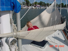
After showers and a quick bite to eat, we were really tired after the long day of fighting with too much wind, so we turned in. Also, since Joe's son and grandson were coming to spend the day and visit in the late morning, we allowed ourselves an extra hour of sleep before they arrived.

Joe and Andrew arrived just before lunch time. After a short visit, we walked to the downtown Village of Cocoa to look for a place to eat lunch and for Sarah to pick up a few souvenirs. We decided to eat at the local Outback Restaurant just over the bridge to Merritt Island. Bill, our waiter, was a New England expatriate and he immediately picked up on Joe's dialect. After we exchanged details of their mutual New England backgrounds, we ordered lunch and practiced our one-handed drink coaster edge-of-the-table "flip up and catch" skills.

After lunch Andrew practiced his helmsmanship skills and we spent the afternoon talking about family, friends, and what was going on in our lives.


While we were talking we noticed a brown floating log in the thoroufhfare between the marina slips. It turned out the log was really a manatee floating on the surface of the water and munching on the grass and weeds in the water below.

It's next to impossible to sight these creatures in a slow moving vessel...in our case, we don't think the dock was even moving. It must be completely impossible to look out and see these slow-moving creatures from the bridge of a power boat moving at 25 mph...the standard speed restriction in any area where manatees gather to eat and do whatever manatees do for a living. Whenever we see one of these creatures, we can't help think about a song about "Hugh the Manatee" written and performed by a Washington couple who perform under the stage name of Magpie (http://www.magpiemusic.com/). With thanks to our friend Allan who did the research, you can listen to Magpie sing about Hugh and read the lyrics at: http://www.sirenian.org/HughLyrics.html !

Saturday, March 15, 2008

Day 99 - 14 March

We left Lake Worth at 9:00 AM and headed out the Lake Worth inlet for the ocean. We arrived at Fort Pierce at 3:30 PM recording an average speed of almost 8 knots.

The wind was supposed to be Southwest at 10-15 knots. Instead it was...where else...on our nose and 5-10 knots. So we motored the entire way. The good news of the day is that the autopilot did most of the work and we were able to relax in the cockpit as we kept watch on our way to the Fort Pierce inlet.

Day 96-98 - 11-13 March

We left Miami Marine Stadium and headed out Government Cut to the North Atlantic. We got to Boca Raton when the engine sputtered. Joe did his usual underway Racor filter changes with little effect except a continually sputtering engine...must be an almost empty fuel tank! Switching fuel tanks only made the matter worse and...uh oh...the water alarm indicating water in the fuel started to sound just before the engine decided its tolerance limits were exceeded and it stopped.

We drifted for a while as Joe poured the 10 gallons of fuel in the on-deck containers into the starboard fuel tank, drained the Racor filter bowls to get rid of the water that was already in the fuel lines and started the engine again. By this time the dive boat we were drifting toward was becoming very nervous...although the safety people on deck didn't recall their divers!

Anyway we made it to the Lake Worth Anchorage where we assessed the problem and made plans to take a slip in the New Port Cove Marina in the morning to figure out how to get the water out of our infected fuel tank.

We decided to do it right and let the professionals handle it. We contacted Marine Environmental Services (http://cleanmytank.com/) and made arrangements with John Cafiero to come to the Marina to assess and remediate the damage. John arrived precisely as promised at 11:00 AM...always a good sign...and went right to work. Within an hour we had clean empty but clean fuel tanks. Since he was already set up to do the work, we had John clean and suck the accumulation of stuff from our bilge and after a short time, we also had a clean bilge.

We had at least two inches of water and the attendant dead bug bodies in each tank and when John was finished we had two empty but clean fuel tanks. So Joe took the aforementioned two 5-gallon diesel containers and trucked them back and forth from the diesel fuel pump to the boat and filled the starboard tank with 65 gallons of fuel at $3.95 per gallon...a new high!

This took most of the afternoon due to the lack of accessibility of the diesel fuel pump. The main reason for the inaccessibility is this marina caters to dry stored boats which are stacked four levels high in two big storage locations. The fuel dock is located at the end of a 200 foot thoroughfare that is only about 75 feet wide...more than enough room the small power boats to fuel up, turn around and leave the fuel dock. On one side of the thoroghfare were some of the small power boats. On the other side were two $4,500,000 yachts...you did read that right and the number of zeros is correct...and there was no room for us to turn around once we got to the fuel pumps. We were really concerned that bumping up against these expensive boats might damage our boat so, Joe trucked the fuel 10 gallons at a time.

We decided to spend a second night at the marina and leave early the next morning to head to Fort Pierce. The wind was favorable for sailing and the wave height was predicted to be less than two feet, so we prepared Windreka for an early departure, showered, watched a movie...Spiderman 2...and turned in.

Monday, March 10, 2008

Day 93-95 - 8-10 March

There were welcoming signs posted all over the anchorage and we certainly felt like guests...all we were missing was for the mayor to come out to the boat and offer us the key to the city. Seriously, cruising sailboaters are finding Florida less and less a friendly place to visit and the state and local communities are doing their best to force everyone into marinas which are becoming more and more expensive...similar to what the luxury tax did for boat sales a couple of decades back!

We awoke at daybreak to winds gusting to 40 knots and heavy rain that continued for an hour or so. After the front passed, the sun came out and even with a brisk wind from the northwest, the crews were able to get a full day of racing in. We didn't have a program so we don't know who was racing, who won, or who lost. But it was interesting to watch in between reading, relaxing and just taking it easy.

There are some boats and boaters that probably should be kept out of an anchorage and we noticed about one third of the boats in the anchorage appeared to be legitimate cruisers. The other two thirds looked a lot like this boat. Despite the presence of the Miami Marine Police, the only boats they were herding around were the boats with people on them. They were ignoring the abandoned boats and boats with no one on them...strange...and we have to say that Miami is the only location on the ICW where we were made to feel less than welcome.


Despite the noise and commotion of the weekend at the anchorage, we were protected from the wind and weather and our anchor only dragged once...a first for the trip! We recovered easily and no damage was done either to Windreka or any other boat in the anchorage.

The skyline was interesting both during the day and at night. Note the Florida colors on the building to the right of center!

No, it's not your eyes...the Miami skyline at night is difficult to capture with a slow shutter speed on the deck of a sailboat bouncing around at anchor...at least that's our story and we're sticking to it!

Day 91-92 - 6-7 March

After refueling yesterday afternoon, we reluctantly cast off our dock lines at noon and headed north. We motored all the way to Rodriguez Key and with the late start arrived at the anchorage on the northeast side of the key after sunset. We felt our way between the several boats already at anchor and found a secure and protected place to set our own anchor. We turned our anchor light on and settled in for the night. The wind blew strongly most of the night but our anchor held and we slept peacefully.

The next morning we arose and got started early to make the entrance to Angelfish Creek when the tide was high. We were able to motor sail most of the way and took down the head sail within a mile of the Angelfish Creek entrance. As soon as we got through the passage, we were able to raise the head sail again on a comparatively smooth Biscayne Bay. Within a mile of the Rickenbacker highway bridge, we lowered the sail and motored into the anchorage at the Miami Marine Stadium.

As soon as we lowered our anchor, a Miami Marine Police boat approached and told us we couldn't anchor where we had on the way south...it was clear and reasonable once we asked and were told. There was an intercollegiate crew regatta and crew races scheduled for Saturday and the crews were practicing on Friday. We moved Windreka to an approved location and had a ring-side seat for the practice sessions and the races the next day.

Day 89-90 - 4-5 March

While we were back at Marathon, planning a cruise into the key area north of Key West and Marathon, we listened to the weather forecast and it looked as if we should remain at Marathon for another several days. We also received a call from Sarah's daughter about the wet and snowy weather at home. Tiffany also sent some photos that gave us serious concern about the continuing lack of ground water drainage around our house. While there was nothing we could do immediately about the accumulated water, it's clear we have to do something more than what has been done so far to alleviate the problem. At least the high water alarm in our sump pump hasn't gone off indicating that the problem appears to be under control. What we don't know is our margin of safety. So we considered our options:

1. Wait several days for the incoming front to pass so we could head into the area of the keys we hadn't visited yet and hope the weather window stayed open long enough for us to get back to Marathon and leave a comfortable amount of time remaining to head back to Beaufort, SC and return home to file our income tax reports and deal with the lack of ground water drainage.

2. Start heading back north and find an anchorage where we could wait comfortably for the incoming front to pass and open a weather window for us to get back into the ICW with a comfortable amount of time to stop at some of the places we missed on the way south before heading home to deal with taxes, water and local government bureaucracy.

Since there were too many uncertainties associated with the first option, we decided on the second and will leave Marathon on Thursday, 6 March. Meanwhile, here are a few photos of the water problem we have to face when we return home to face what keeps us awake at night while we try to enjoy retirement. The photos on the left were taken a few days ago. The photos on the right were taken a year ago.

This photo looks even worse than a year ago when ground water completely filled the south and west side of our property to a depth of more than a foot. The water was prevented from flowing downhill following the natural grade of the land (to the southeast) by the lack of a drainage ditch along the township road on the south side of our house (foreground of the first photo), the lack of a culvert under the township road and the lack of a drainage ditch along the county road to the east of our house (left side of the first photo).

When the problem first appeared, we contacted the township and the county authorities whose first reaction was it's not their problem. After several meetings with the township and county, both agreed to support development of a road project to improve the drainage, but only because ground water had risen to cover the township road. Of course in keeping with a government bureaucracy, the county insisted on a study and we were told that without such a study, the project would be disapproved, but might be approved the following year if adequate justification (e.g., the aforementioned study) was included.
We volunteered to assist with development of the project documentation. However, our offer to assist was ignored, the deadline for submission of the project passed and, to our knowledge, the road project was not developed adn submitted. So, after over a year of discussion, there has been nothing done to solve the problem!

This isn't completely surprising since local governments tend to ignore ground water problems. Years ago, when farmers had a ground water drainage problem, they installed clay pipe...so-called "tiles"...to drain their fields and let them plant crops. Local government were quite happy to let the landowners deal with their problems...especially since they weren't prepared to deal with them.

Fast forward to the present and these same local governments still operate the way they did 50 years ago and are still not prepared to deal with water drainage problems. Instead they rely on the old, broken drainage systems installed by the farmers years ago. There aren't even any records of where these drainage systems may have existed and many farms have been broken up into local government-approved house lots. In our area, one house can be built on two acres.

To exacerbate the growing water drainage problem, local governments issue permits to build houses and permits to occupy houses and levy taxes without addressing the increased water drainage problems resulting from the houses they have approved. On the other hand, they collect real estate taxes without setting aside some portion of these taxes to address the lack of a drainage and sewage infrastructure.

We believe the water drainage problem is the tip of just one of the icebergs facing these local governments. However, with the exception of a few open-minded people, most of the local officials we have met and talked to, are not even willing to consider that there might be a common problem. Meanwhile water is impeded from flowing downhill by the lack of a proper drainage system.

Friday, March 7, 2008

Day 88 - 3 March

The Dry Tortugas are legally an unincorporated part of Monroe County, Florida and the Lower Keys. The Dry Tortugas National Park consists of seven islands, or keys and the surrounding reef. Located on Garden Key is Fort Jefferson, the largest 19th century American coastal fort. The fort is surrounded by a moat which now serves to protect the walls of the fort from weather by breaking the waves before they reach the walls. The light that was built on Garden Key just visible in the center picture above the walls has now been replaced by a lighthouse on Loggerhead Key, the largest island of the Tortugas which can be seen in the map on the right and in the photo below.


We left Marathon and headed for Key West at 6:00AM to get on one of the two ferryboats to Dry Tortugas National Park at 7:30AM. The ferry we took was the less expensive and was run by Sunny Days (http://www.drytortugas.com/) and advertises itself as the fastest ferry and the name of the boat name is Fast Cat. The cost was $120/adult with a $10 discount for seniors (over 62). The other ferry was Yankee Freedom II (http://yankeefreedom.com/) and cost $149/adult. It advertises itself as the largest, most stable and comfortable way to get to the fort. Both vessels were there today. The tours advertised by the ferry services are actually run by a Park Service Ranger who conducts a guided tour of Fort Jefferson.

We would have preferred to sail Windreka the 70 miles from Key West to the Dry Tortugas and pictured her in the natural harbor in front of Fort Jefferson. However, the weather conditions weren't right and we were concerned about getting stuck for several days while we waited for the weather to clear. So, the second best thing was to take a ferry to the Dry Tortugas. As it was, the trip back was a bit rough and the Fast Cat wasn't as fast as it was advertised to be. In fact it frequently had to slow down to avoid bashing into high waves and deep troughs on the way back to Key West...but that was all right with those of us who value safety and comfort over recklessness and discomfort.

Bush Key is the closest to Garden Key and is not open to the public for several months of the year. It's the habitat for Sooty Terns which nest during the restricted months (September thru April) and we could see many of them flying above the island. The shoal area to the left of Bush Key is part of the channel into the harbor at Garden Key which is just visible at the lower left of the photo on the right.

Frigate birds are another winged inhabitant of the Dry Tortugas. These amazing birds have a wing span of seven feet, yet only weigh about three pounds soaking wet. Hundreds of them can be seen soaring on the thermals above the fort. Except for flapping their wings to climb into the air to find the thermals and to land, they seem to glide effortlessly overhead enjoying themselves and not making any sound that we could hear. What a life!

In addition to the birds and the lovely water, Fort Jefferson is the main attraction at Dry Tortugas. The Fort was built as part of the system of coastal defenses built between 1817 and 1867. Within a half mile of Fort Jefferson is a natural anchorage bowl of approximately 50 feet deep and two miles in diameter...the only anchorage between Chesapeake Bay and the Rio Grande deep enough to host the battleships of 1898. The guns of Fort Jefferson commanded the anchorage and with a fleet of battleships berthed in the anchorage and scouts spread out over the navigable waters nearby, naval control could be exerted over the Gulf of Mexico and the nearby islands of the Caribbean and the Bahamas.

Construction of the fort was never completed and during the Civil War, it remained in Union hands and became a military prison for captured deserters. You can read more about the Dry Tortugas at http://en.wikipedia.org/wiki/Dry_Tortugas and enjoy the photos we took while we were there. The official National Park Service web site for the Dry Tortugas is: http://www.nps.gov/drto/

The big powder magazine is depicted on the first photo. There were several powder magazines planned or built and this was the largest. If it's readable on the weblog, the plans for the powder magazines is outlined on the next photo. The third photo shows the bins where the powder was to be stored inside the magazine.
Inside the fort looking north toward the US Park Service rangers' apartments and the foundations of the officers' barracks. The big magazine would be just behind the fort structure on the right hand side of the photo.


Fort Jefferson was constructed with arches everywhere. The coral limestone foundation for the fort was inadequate to support the heavy weight of the fort walls and the installed weapons and the arches helped reinforce the walls. In addition, well over a hundred cisterns were built into the walls all around the perimeter of the fort to catch and hold rainfall as the only source existing source of fresh water without having to import it.


Arches were also a strategic engineering plan to help deflect cannon shot from an attacking vessel and if the shot hit the fort and did damage, the arches helped ensure the walls would not collapse.


The old lighthouse on top of the fort is another example of the heavy weight the walls of the fort were asked to support.


Looking toward the west with the foundations of the officers' barracks and the Park rangers' apartments in the background.


The casement windows all around the fort were once protected by iron shutters that opened when the cannon was moved into firing position. After the cannon was fired, the recoil pushed the cannon back into the casement and the shutters closed automatically to protect the crew of the cannon until they were ready to fire the next shot. Unfortunately, the shutters were made of iron and didn't last long in the salt air. Neither did the bricks and mortar surrounding the casements. There is currently a three-year project going on to repair and restore the shutters, brick work and mortar around the casement windows.

Still another heavy item located on the top of the fort walls were the huge parrott rifles. The parrot rifles were an innovation that improved the accuracy, range and lethality of artillery. Grooves were cut into the barrel of the cannon to impart a spin on the artillery shells that stabilized them in flight and enabled them to travel further and do more damage (compare the range of a football to a basketball). Interestingly, the development of the parrott rifle also made the series of forts that made up the defenses of the coastal United States obsolete. That's one of the reasons Fort Jefferson was never finished.

The building on the right is a "hot shot" furnace, where cannon shot was heated to cherry red color before it was fired at enemy vessels. The idea was to set the enemy ships on fire. What's not clear is how the hot shot was to be moved to the cannon for firing...or maybe I missed a key part of the concept!


During its role as a Civil War Union prison, probably the most famous of the "residents" at Fort Jefferson was Dr. Samuel Mudd, one of four men convicted of complicity in Abraham Lincoln's assasination. These prisoners were housed in one of the casements and the walls were bricked over except for the narrow "gun slits" at the top of the walls. These slits represented the only ventilation the cell had. In addition, rainwater was collected by the prisoners by digging trenches and catch basins in the floor of the cell to catch the rain that leaked into the cell from the roof of the fort whenever it rained. It doesn't sound like life was pleasant for these prisoners! When the fort surgeon was stricken with malaria and died, Dr. Mudd volunteered to treat the soldiers and prisoners at the fort. For this action, Dr. Mudd was later pardoned.

Spiral staircases were the means of getting from one level to the next of the fort. The steps were large rectangular granite stones set into the walls of the fort around a central vertical axis. This technique of constructing steps was a common way of making strong stairwells. One other example of this construction is the Old Executive Office Building east of the White House. The steps in the OEOB were much larger and wider and just as strong. Neither steps moved when you stepped on them!

After the return trip to Key West, we ended the day at Mallory Square for one last viewing of the sunset and the various street performers. We didn't actually watch the sun set since it probably looked like it did the last time. We did catch a neat shot of the sun as it sank low behind the sailboat on the right. There are many opportunities for such interesting photos and if you don't have a camera, there is no shortage of street vendors who will sell you a photo they have on display. One act we wanted to see this time was the Great Rondini who was a Houdini-like "escape" artist. We never saw Houdini perform, but the Great Rondini was both humorous and successfully "escaped" from a strait jacket and chains that volunteers from the audience wrapped around him. The volunteer in this photo was named Anna and her role was to be embarassed as Rondini cracked his jokes. All in all, not a bad act and we left a tip for him. It was interesting to see his children laying behind the green platform playing with their Ipods and ignoring their dad's performance...probably heard it one too many times.
After leaving Mallory Square, we decided to have one more meal in Key West and stopped at the Turtle Kraals again for a light dinner. On the way we passed another key lime pie factory and couldn't resist taking another pie back to Marathon with us...after all a boat without a key lime pie is like a day without sunshine. This one would last us until we got back to Miami...now that's discipline!

Day 87 - 2 March


Thursday, March 6, 2008

Day 86 - 1 March

The only thing to report here is that we dropped Phil off at the Marathon airport to catch the Greyhound bus to Fort Lauderdale and his plane back to Virginia. We were saddened by his departure and both of us returned to Windreka wondering where the week had gone. We don't often say this about visitors to our home on the water, but Phil was a worthy shipmate and we had a lot of fun during the week he spent with us. We wish he could have stayed longer!

Later in the day we joined friends and fellow Whitby sailors, Pat, Greg and Judy for lunch at the No Name Pub (You Found It!) on...where else...No Name Key. We ordered our own pizza and had enough for two more meals on the boat.

Sunday, March 2, 2008

Day 85 - 29 February

Question: How does a sailboater celebrate the 29th of February?

Answer: Visit the Turtle Hospital in Marathon (http://www.turtlehospital.org/), the Shipwreck Museum (http://www.shipwreckhistoreum.com/) and Mel Fisher Museum (http://www.melfisher.org/) in Key West...and, of course, the mandatory pilgrimage to Mallory Square!

It was an interesting and full day. We returned to Key West to do some land touring and to act like several of the thousands of tourists who flock to this Margaritaville and madness mecca.

However, before we headed to Key West, we visited the Turtle Hospital in Marathon. The hospital is a unique organization with a mission to rescue, rehabilitate, and release sea turtles that are injured either by the negligence of humans or by one of their natural predators...sharks, for example. Peggy was our guide and gave us a lecture to introduce us to sea turtles and the work of the hospital. Sea turtles are found in all the world's oceans except the Arctic Ocean. There are seven species of sea turtles: flatback, green, hawksbill, Kemp's Ridley, leatherback, loggerhead and olive ridley.
The leatherback is the only sea turtle that does not have a hard shell. Instead, it has a mosaic of bony plates beneath its leathery skin. The loggerhead is the largest of the sea turtles, measuring six or seven feet in length at maturity, three to five feet in width, and weighing up to 1300 pounds. Other species are smaller, for example, two to four feet in length.

A turtle is considered injured when it is found floating on the surface of the ocean and can't dive under. Anyone who spots a turtle in this condition...whether or not there is any other evidence of distress...can call the Turtle Hospital who will arrange to have the injured turtle brought to the hospital. The hospital receives as many as 70 injured sea turtles a year and has released more than 750 sea turtles to date. The hospital uses the services of a volunteer reptile vetrinarian and has the ability to perform surgery. There is even one turtle that is being fitted with a prosthetic device to replace the flipper lost to a shark

After an informative and interesting hour, we headed for Key West. Our first stop was at the Turtle Kraals for lunch. The restaurant is located on the site of a green turtle "corral" which was once used to produce green sea turtle soup before the turtles became an endangered species. In retrospect, this was an interesting contrast…first we visited a place dedicated to the preservation of turtles and then we visited a place where turtles were slaughtered to make soup. Lunch was very good and turtle soup wasn’t on the menu! While we were eating a contingent of “suits” trooped in and sat at a table near us. At the same time, several armed Customs and Border Protection agents took up strategic positions surrounding the restaurant. Of course, Sarah couldn’t resist moving in on one agent and inquiring what was going on, who they were protecting, etc. I’m not certain she learned anything, but she did manage to get her photo taken with one of the agents!

After lunch we visited the Shipwreck Historeum where we learned the story of the Florida Keys wreckers or shipwreck salvagers. The wreckers began their trade on Key West in the 1800s and made Key West one of the most prosperous location in the United States. In the mid-1800s ships were piling up on the reef at the rate of nearly one a week. The museum is a reconstruction of a wreckers warehouse containing items salvaged from the Issac Allerton which sank on the reef in 1856 and was the largest individual award by the federal court in Florida…or wrecking court…in the history of wrecking.

Above the warehouse/museum is a tower the wreckers used to keep a lookout for ships grounding on the reef. When a ship went aground on the reef, the cry from the tower of “Wreck Ashore” alerted the town and the race began to lay hands on the hull to claim salvage rights. The dark side of the humanitarian work of the wreckers is the rumor that some navigation lights were moved to mislead ships approaching the reef…now who would think of doing something like that?

The second stop on our touring itinerary was the Mel Fisher Treasure Museum which contains items salvaged from the wreck of the Nuestra SeƱora de Atocha (Our Lady of Atocha) which was the most famous of a fleet of Spanish ships that sank in 1622 off the Florida Keys while carrying copper, silver, gold, tobacco, gems, jewels, jewelery and indigo from Spanish ports in the Western Hemisphere. In 1622 the Atocha was driven by a hurricane onto the coral reefs near the Dry Tortugas.

In case you don’t remember the story, American treasure hunter Mel Fisher and a team of sub-contractors, funded by investors and others in a joint venture, searched for the Atocha for 16 and a half years; potential helpers were discouraged by the fact that this dangerous professional diving job was at minimum wage unless the ship was found. The Atocha wreck and its mother lode of silver, gold and emeralds was finally discovered in 1985. After the discovery, the U.S. government claimed title to the wreck, and the State of Florida seized many of the items retrieved by Mel Fisher. After eight years of litigation, the U.S. Supreme Court finally ruled in favor of Fisher and the items on display in the museum are owned by the Fisher family.

After we left the museum, we discovered a neat place we wish we had included on our itinerary…the Key West Museum of Art and History. It looks like it would have been an interesting tour, but it was closed when we discovered it and we had other things on our agenda. Actually, we missed a number of interesting things like President Truman’s Little White House, the Custom House Museum, the Key West Lighthouse Museum, the Butterfly and Nature Conservatory, etc. We did manage to snag a photo of a couple standing outside the door of the Art and History Museum and had our pictures taken with one of the more famous Key West celebrities...we think he wrote a story about an old man and a fish...probably true since he had a fishing rod in his hand when we found him!


It was now time for the Sunset Celebration at Mallory Square and we hurried to the bulkhead to take our place with several hundred close friends. Predictably, the sun set at the appointed time and the crowd went wild. Before and afterwards we walked around the square to catch a few of the street performers who work for tips…some of them even were talented. All were entertaining and since we were going to be in Key West to visit Dry Tortugas, we’ll probably drop by to see if we missed anything.
Perhaps we'll even be back to celebrate the next "Leap Year!"
One last item...on our way back to the car to return to Marathon, we stopped at the Key Lime Pie Factory (http://www.blondgiraffe.com/) and bought a whole pie. After we got back to the boat, the three of us ate half of the pie with no apologies for our indulgence. It was wonderful and worth every calorie. It may even live up to its advertisement "Best Key Lime Pie in Key West and Florida...5 years in a row!"