Friday, December 21, 2007

Days Ashore - 7 thru 21 December

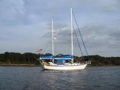
We decorated Windreka, said goodbye to our marina friends and departed South Carolina for colder northern weather on Friday afternoon, 6th December as a great fog was rolling in...reminded us of the foc'sle chantey, The Irish Rover. Friday night, we spent our first night in several weeks in a motel with a floor and a bed that didn't move...now that was exciting!

We made it back to Joe's daughter, Jen's home in Maryland on Saturday, the 7th and friend Sunny Fitzgerald's annual Christmas party later that evening. Everyone wanted to know "how it was?" and our stock answers consisted of somewhat-but-not-too-exagerated descriptions of how cold, how windy and how tough it really was...then we told them the truth...we had the time of our lives and it was really a great experience. Much of the time we were met with puzzled expressions and we realized again that what we are doing is a bit unusual to our land friends. At least we hadn't run into snow until we returned to Maryland...making us realize why we left in the first place.

On Sunday, the 8th December, we left snowy Maryland for snowy Ohio and were home by late afternoon in cold, windy weather. We didn't have much time to think about the 80-degree weather in South Carolina as we had a refrigerator to restock, a house to decorate and preparations to make for Christmas visitors. Actually, Frank calls Joe every few days to remind him how nice it is in South Carolina and to listen to Joe tell him how cold it is in Ohio.

Since we returned, time has gone by quicker than we thought it would. We just looked at the calendar and realized we've been back home for almost two weeks and it's Christmas in four days...Holy Smoke...hope we've got all our Christmas shopping done!


Family Dinner at the Refectory

Christmas is a moving experience this year. As mentioned, Sarah's son Cliff and his family were visiting with us last week and we had an early Christmas with both Sarah's children and their families while everyone was together. After Christmas, Joe (and maybe Sarah) will visit with Joe's daughter, Leanne and her family in St. Louis...then a visit with Joe's daughter, Jen and her family before we head for warmer weather in January...then a visit with Joe's son, Joe and his family whenever we get to Florida. We've decided it's impossible to get the entire clan together all at once and so we have to have family time in smaller bites.

We are slowly planning the next phase of our cruising adventure. Today, Joe celebrated after finally getting his new boat computer working. He is loading his navigation software on it and getting it ready to install on the boat. We are beginning to gather the stuff we need...charts, warm-weather clothes, etc...when we return to the boat and although our focus is on Christmas and family...as it should be...we are already making tentative plans to rendezvous with friends and fellow cruisers, Greg and Judy whose boat, My Destiny is in Brunswick, GA...about 100 miles further south than Dataw Island.

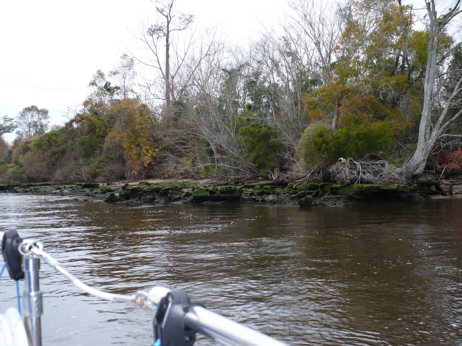
We also keep in touch with our friends who are still on their boats and at various places heading south along the ICW. We're looking forward to getting back aboard in January to join them in this adventure that so many, but so few experience.

Now, where did we put that last minute Christmas shopping list?

Saturday, December 8, 2007

Days 18 & 19 - Thursday & Friday, 6 & 7 December

If you go to the Dataw Island Marina web page at http://www.datawmarina.com/, here's what you'll read: Dataw Island Marina is one of the finest marinas located on the ICW. The well-designed and well-maintained facilities are a pleasant and quiet destination for the demanding yachtsman. The marina has state-of-the-art concrete floating docks, constructed with concrete pilings and includes a wave attenuator dock surrounding the basin. Amenities include an on-site waterfront restaurant and bar, modern air-conditioned showers and laundry, cable TV, courtesy bikes, 24-hour security, and competent and accommodating staff. This is a first-class facility where you will be treated royally. The marina is strategically located 50 miles south of Charleston, SC, 14 miles from Beaufort, SC, and 35 miles from Hilton Head Island. This is an accurate description of the Marina and we are pleased to be keeping our boat here. The staff is friendly, courteous and professional and the facilities are first rate.

On Thursday, we got a bit more serious about getting work done...starting about the crack of mid-morning...after all, Joe and Frank need their coffee to get them motivated. We also slept almost an hour longer than we have for the past two weeks. During the day, we met some more of our neighbors and walked around the docks to look at the interesting assortment of sail and power boats that live here. We intended to do more work than what we did, but we preferred to spend some time socializing and getting familiar with the neighborhood. We also had two weeks of laundry to catch up on, so after lunch, Frank generously lent us one of his cars and we went "downtown" to a laundromat. For the next three hours, we did three triple loads and two single loads of laundry...at least that's what the sign on the washing machines said. By the time we finished it was late afternoon and the only thing to do was to return to the boat for some more socializing. Frank and Joe spent a lot of time on important things like catching up on events of the past several years. We were doing so well at it that we talked right through dinner until Joe pulled out some snacks from the refrigerator while we kept talking. When we realized it was almost 1:00 AM, it was time to turn in and not much planned work got done...but no worries, mate...we're retired and that's grand!

Friday morning brought a pleasant surprise. While enjoying his morning coffee, Joe received a call from Woody Sherrod who was about five miles away and heading our way looking for a good, affordable marina for overnight. Woody's wife Annie was with him, having come back on board Marisol at Wilmington. About an hour later Marisol was tied up to the face dock for the night with the help of the welcoming committee of Frank, Sarah, Joe and the same helpful marina crew that assisted us when we arrived. Cruising is a bit like Forrest Gump's proverbial box of chocalates...you never know what's going to happen next!

As it turned out Woody and Frank are also friends, so we had a reunion and swapped some more lies and tall tales of boating and times past for most of the rest of the day. But we had places to go and people to meet, so in the afternoon, Woody and Angie went grocery shopping and made the obligatory stop at West Marine for some needed boat things while Frank and Joe went to Savannah to pick up a rental car from Hertz. Another boat had come into the marina with a delivery skipper from Deltaville, VA who was also heading for the airport to pick up a rental car to return to Deltaville. Keith hooked up with Frank and Joe and to drive to the airport. One of the amazing things about life on the water is that cruisers always come together to help each other out whenever needed. It really is a small world and good turns are always returned. For cruisers...just as for those who have been in Scouting as a youngster or an adult...it's a natural response.

Friday, December 7, 2007

Day 17 - Wednesday, 5 December

We've arrived! After turning into Parrot Creek at mile marker 521 on the ICW, we worked our way down the creek to the Morgan River and turned right toward Dataw Marina approximately 2 miles away. We worked our way up to the face dock and with the assistance of Pete and the Marina crew and friend Frank, we tied up at approximately 1:30 PM in a west wind and a tidal current of approximately 2 knots at mid-tide...something we don't even think about on Chesapeake Bay...driving the 5 foot tide into the river. The strong tidal currents and five foot tides are one of the situational factors we are learning to cope with. Cruisers routinely experience these factors along the southern part of the ICW and both currents and tide get stronger and higher as we move south. Maneuvering at dockside is a LOT different here and it really tests a skipper's ability to control his boat in close quarters...we're grateful we have a bow thruster. What's a "bow thruster" you ask...

Bow Thruster Inside and Outside Views

Another Useful Maneuvering Device...In-place and After Being Tuned...


After introductions to the very competent and friendly Marina staff who helped with our docking lines...very welcome given the current and wind...we decided to wait until slack tide to move Windreka into her slip. Joe made a trip up to the Marina office to meet Ron the Marina manager and sign a contract for the slip for the next two months...tariff is $9.75 per foot and $55.00 for a 50 amp electrical connection...about the same as we were paying at Herrington Harbour South. One difference, here the slips are rented on a month to month basis and there are no long term contracts.

After Joe returned to the boat to help Sarah square things away and get ready for life in a marina again, we refilled our almost dry fresh water tanks and topped off the port-side fuel tank. Ron came down with his tape measure to measure Windreka's length. Measurements were taken both fore to aft and aft to fore. The result 51 feet including the anchors and ensign!

At that point it was almost 4:30 and we enlisted Pete and the Marina staff again to help us tie up at our new slip. With the help of Frank at the bow and Sarah at the stern, Joe maneuvered Windreka around the face dock and into the Marina proper to a slip opposite Frank's slip where his Endeavour sailboat, Wander is berthed. It was still windy but the tidal current had slackened and we got Windreka retied up where she will live for the next couple of months.

After 16 days at anchor, it was great to connect up Windreka's electrical systems to shore power and not have to manage battery charging. The Link interface and the Heart 2500 inverter charger took over promptly, the reverse cycle air conditioner began pumping out welcome heat and life was indeed good...time for a relaxing libation and movement on a surface that doesn't move around under your feet...on the other hand, the docks are floating concrete and they do move...just not the same as a vessel underway.


About the same time the aroma of a pot of chili began wafting into the cockpit on the west wind from Frank's boat. We joined Frank, Lieutenant Sophie (boat dog) and Pete...of dock line handling fame...for chili, beer and socializing. Earlier this year, Pete and Frank had been hunting fossilized shark's teeth nearby on the Morgan River and had some very large shark teeth...google megalodon...to show us. The fossils were impressive and I'm grateful the megalodon species is apparently extinct...note apparently! You probably don't want to meet this thing the next time you go for a wade in the water!


We retired early, but the next couple of days have been eventful and we'll post the happenings on another post. This post is being written after the fact from a hotel room about 150 miles south of Richmond as we make our way over land on the next phase of our cruising activities.

Stay tuned!

Tuesday, December 4, 2007

Day 16 - Tuesday, 4 December

The great question of the day is why are we having the coldest weather of the trip, now that we've arrived in South Carolina? Did the earth turn upside-down on its axis? Are we going north instead of south? Are we just imagining it to be colder? Who knows?

The good news is that we will be arriving at Dataw Island Marina tomorrow by early afternoon. We have a reservation and the marina has a laundry, showers, fuel, relatively affordable costs, concrete floating docks, good security, etc., etc.

We are excited about getting there, visiting with long-time friends Frank and Debbie, getting back to Ohio, visiting with family and friends for the Christmas Holidays. During that time, I'll try to keep the weblog up to date as part of our adventures.

We are currently at an anchorage on Church Creek, at mile marker, 487 in 17' of water and little or no wind. I have 75' of anchor chain out just in case.

The only difficulty we had today and on this trip is getting across Charleston harbor. Here's what happened. We emerged from the ICW into Charleston harbor, leaving 130 on our starboard side on our way across mile marker 465...no problem. We began searching for R"2" on the channel...wait that's R"26"...no it's R"2" on the MAPTECH Chartkit, Norfolk to Florida and the Intracoastal Waterway, Region 6 Ninth Edition, and R"26" on the Intracoastal Waterway Chartbook, Norfolk, VA to Miami, FL. Wait, the Chartbook contains charts that are updated to 2001 and the Maptech Chartkit contains charts that appear to be more accurate. After a few tense moments, we were able to sort out the marks and geography around us and continue down the channel on the South side of Charleston harbor to the Wapoo Creek entrance. I guess the moral to the story...if there is a moral to the story...is sometimes having an alternate source of navigation information can be confusing...especially if the two contradict each other. It's probably better to be aware of the contradiction before you start using the information and that's what I failed to do. The date of the charts in the Chartbook should have been a red flag. Instead I looked at the front cover of the Chartbook each day and looked right past the warning.
And we almost missed Fort Sumter...now that would have been really embarassing!
After crossing Charleston harbor, we made it to the anchorage by 3:15 PM, dropped the anchor and took a nap...life at 6 miles per hour can be both stressful and very relaxing!

Monday, December 3, 2007

Day 15 - Monday, 3 December

It was a mild but blustery day with strong winds...25-35 knots...from the Southwest...right on our nose of course! Graham Creek was the best of the worst choices for an anchorage at the end of our cruising day today. All anchorages in range were unprotected on all sides except for Graham Creek which offered only a higher bank on the W/SW side between us and the wind. Since the choices were all less than appealing, we decided to motor into the creek to check things out. When we turned left at the red "64", we found what looked like shallow water, but as we moved into the creek, the water was 10 feet deep almost to the banks and the W/SW bank did indeed offer enough protection from the wind.

So we lowered 60 feet of chain, snubbed it in 9 feet of water and backed down to set the anchor. Since it was mid-afternoon, we decided to defrost the refrigerator. We turned on the generator to power Joe's heat gun and pulled everything out of the freezer to melt the accumulation of ice on the holding plates. When the job was done a couple of hours later, we repacked our frozen foods, turned on the refrigerator and watched as the temperature dropped to its operating range.

There was still enough time left over to sit in the cockpit and watch the sunset after another day on the water. By evening, the wind had gotten lighter...or maybe it was because we were protected in the anchorage. Unfortunately, the balmy weather of the past couple of days will turn colder as a couple of weather fronts move into the area for the next few days. However, we shouild be at our destination early on Wednesday at Dataw Island Marina...next to friends Frank and Debbie Ylinen who live on their Endeavor 43, Wander.


Bad Day Version 2

Sunday, December 2, 2007

Day 14 - Sunday, 2 December

We are anchored in Thoroughfare Creek off the Waccamaw River in a secluded cove that might as well be thousands of miles from anywhere. Yet I am logged on to the internet courtesy of my Verizon broadband account posting this weblog entry. Earlier, I spoke into the keyboard of my comuter and talked with a friend in Canada and got a call from my daughter in Saint Louis. Still earlier, we also spoke from our boat with a small Sunday School group we belong to when we're at home. We live in amazing times and have amazing technology at our disposal!

Today, the weather was mild with a slight NE wind and partly cloudy skies. We are three days away from arriving at our immediate destination...the Dataw Island Marina just north of Hilton Head...where we will leave our boat while we return to Ohio to celebrate Christmas with our families.

Sometimes the ICW is a menagerie of sights and scenes. Sometimes it is mile after mile of marshland. Today was one of the former and following...in no particular order...are a series of photos from our travels down the ICW today:

Saturday, December 1, 2007

Day 13 - Saturday, 1 December

Wrightsville Beach to Myrtle Beach...a distance of approximately 80 miles...turned out to be a bit too far, so we settled for arriving in South Carolina at sunset and anchoring in Calabash Creek north of Myrtle Beach. It was a long day, but we kept at it despite slowing down as we passed each inlet to follow the temporary buoys installed to help boats with deep keels around the extensive shoaling that is taking place. The Coast Guard budget used to keep the ICW dredged and open is not adequate to let them keep up with their work on this beautiful waterway due to their increased role in Homeland Security. We appreciate their mission priorities, but we've had about $300 worth of bottom paint scraped from our hull on this trip so far. At the end of the day the guy at the right is exhausted and we still have another 200 miles to go!

We have a routine we observe each day
  • Up at 6:00 AM...Joe coffee and Sarah juice and breakfast
  • Anchor up at 7:00 AM and motor into the ICW from our anchorage
  • Lunch underway
  • Turn off the ICW into an anchorage before sunset
  • Anchor down, stow things away until the next day
  • Shower and cleanup
  • Dinner and TV or radio or DVD or conversation
  • Turn-in
  • Repeat all above the following day.
Actually, there is a lot more going on between the lines than stated. For example, while we are motoring, Sarah, the chief navigator is updating our position on our charts, finding those elusive buoys that hide in the sun or shadow or shoreline, keeping the green and red marks on the proper side of the boat, noting details of our trip, and managing cockpit ventilation by zipping or unzipping the side curtains. Joe, the chief helmsman is keeping the boat in deep water, looking out for other boats approaching or overtaking us, and asking Sarah for all sort of trivial information to keep a sense of where the boat is with respect to her surroundings, etc. The cockpit is our office and the center of all our activities during the passage. We are surrounded by charts; cameras; binoculars; discarded hats, coats and gloves; sunglasses; water bottles; VHF radios; cell phones; etc.

An inlet is basically a break in the shoreline where a river flows into the ocean and the ocean tides flow back into the river. The tidal flow is strong in this part of the country and the currents are swift. For example, we can usually count on moving in the water over the ground at about 8 miles per hour. A tidal current can easily add to or subtract from another 30% to our speed. For example, today we saw speeds as high as 11 miles per hour and as slow as 4.5 miles per hour. in the vicinity of the inlets depending on which way the tide was flowing. We passed four inlets today and had to slow down to idle speed as we crossed each inlet. There was extensive shoaling where the ICW and each inlet met and there were several additional buoys or "marks" placed on the ICW at each inlet to mark where the tidal currents had carried and deposited sand to get in the way of innocent sailors like us. Fortunately, we didn't run aground today, but could have if we hadn't been vigilant as we passed each inlet.


There are a number of sources of continually updated information about the ICW and its many shoal areas where cruisers can update their charts and keep current on new hazards and other obstacles. One of the best sources of current information is the Salty Southeast Cruisers' Net at http://www.cruisersnet.net/index.php. We use this source as often as we can log on to the internet to update our local knowledge. Sometimes, we have something to report and we can also log on to the web site or address an email to one of the Cruisers' Guide authors. Within hours of such a post, the message is uploaded and available for any ICW cruiser to read.


Tomorrow will be the last day on this cruise that we will be accompanied by Woody Sherrod and his trawler Marisol. Woody will be stopping tomorrow at Myrtle Beach to meet his friend Annie who will be flying in on Tuesday. Woody has been a tremendous source of information and "local knowledge" of the ICW and we have appreciated his friendship, advice and help since we first started down the ICW back at Great Bridge. We hope it won't be long before we have another opportunity to cruise with him. Thanks, Woody for more than we can mention in this weblog...we have thoroughly enjoyed sharing cruising, conversation and anchorages with you over the past 200 miles...we owe you a deck of boat cards!

Friday, November 30, 2007

Day Twelve - Friday, 30 November

Well we were aground again...this time at anchor. We pulled into Mile Hammock last night and anchorage was deserted except for one other boat. We had plenty of room in this large, well-protected anchor basin, the wind was calm and the water was flat. We lowered the anchor into more than 7 feet of water, let out more than 50' of chain, snubbed the anchor rode and went below. Sometime around 3:00 AM, the anchor alarm went off, so we got up checked the anchor and the anchorage. All was well, the wind and water were calm and our boat hadn't moved, so we went back to bed. By 6:00 AM, the wind was 20-25 knots from the NE and we were in 2.5 feet of water. Sometime between 3 and 6:00 AM, the anchor dragged when the wind shifted and grew stronger and we ended up being blown back toward the shallow end of the anchorage, aground at low tide. As if to reinforce our predicament, a small boat came into the anchorage and a fisherman jumped out of the boat and began wading toward us.

Woody Sherrod called and opened the conversation with a question: "You're aground, aren't you?" and "I'll be right over!" Within a few minutes, Woody dinghied up and made a few depth soundings with his portable depth sounder. We were only a few feet from 7 feet of water, so with Woody pushing on Windreka's bow with his dinghy and me at Windreka's throttle working the engine gear shift and throttle and our bow thruster, we managed to get off the shelf and floating again. Within minutes we were on our way again and the rest of the day was without incident.
A short time after we left the Mile Hammock anchorage, the sun came out and Sarah was almost able to get her full daily dose of sunshine. We were relaxing and enjoying the morning sunshine as we were motoring along in the vicinity of the New River Inlet. Suddenly we ran into pods of dolphins that would approach Windreka and swim alongside of her in pairs or singles. It's always a thrill to encounter these wild sea creatures in their natural habitat and have them swimming along beside our boat as if we were old friends

By 2:30 PM we were at anchor in the Wrightsville Beach anchorage and making plans for grocery shopping, a run to West Marine, and dinner with friends Marily and Allan DeWall who own a condominium here between the anchorage and the ocean.
Sunrise at Wrightsville Beach...................................................................................and sunset!

Day Eleven – Thursday, 29 November

We are at Mile Hammock tonight. Skipper Bob’s Anchorages Along the Intracoastal Waterway describes the anchorage this way:

“Mile 244.5, {3.6}, Mile Hammock Bay, (34421): Basin dredged out by military for use with Camp LeJeune. Popular anchorage between Morehead City and Wrightsville Beach. Eastern half of basin not dredged! Note marker buoys on chart. Entrance channel and basin dredged to >8’ MLW May 01. Anchor in 10-12’. Use anchor light at night due to military maneuvers. Shoreline is restricted military property. (#4, 12, 52)”

Skipper Bob’s information is accurate and detailed and we use this and some of the other references we mentioned in an earlier post extensively. There is a vast amount of information available for the ICW cruiser, and yet…here it comes…not everything can be predicted.

Today…despite the information readily available…we ran aground. Today…despite the experience of many years of sailing…we ran aground. And I don’t mean just aground. We ran firmly aground and it took many years of sailing experience to get us off. Here’s what happened.
There is a notorious section of the ICW we crossed today near Camp LeJeune where there has been much information published about shoaling and how to avoid the problem. We noted the information and yet when our turn came, we ran aground. We had stopped to refuel at Casper’s just before mile marker 230 and Woody had gone ahead in Marisol. About an hour later, he reported passing the notorious area and had indeed seen shallow water under his keel. He passed a temporary buoy, “61A” on the proper side and had made it through without a problem. He also reported watching a sailboat as big as ours passing the same buoy on the improper side and watching it make it through without a problem. The proper way to pass a green buoy is to keep the buoy to your port (left) side, so we decided to do the practical thing…when it was our turn, we would keep the buoy on our starboard (right) side.

As we approached the notorious “61A” buoy, there were two other large sailboats trying unsuccessfully to pass the buoy on the improper side…keeping it on their right or starboard side. As we got closer, the two boats began motoring north, warning us of the low water as we passed. Because these two sailboats had been having difficulty, we decided to go back to basics and pass the buoy on the proper side, keeping to our left (port) side. We were only about 10’ away from the buoy when we suddenly saw 2.5’ beneath us as we ran aground. We need 5’ and we were now firmly stuck in 2.5 feet of mud and it took almost 20 minutes to get us free.

To paraphrase a famous saying, “It happens!” We had ignored lots of good advice and that was the major reason we had a problem. The good news is that it only delayed us about a half hour and the anchorage was only a few miles beyond where we got stuck. Within an hour, we were anchored in this quiet little cove with two other boats…one our sailing buddy and the other a potential new friend!


If Running Aground Wasn't Enough, the Marines Threatened to Shoot At Us!


The rest of the day was uneventful. We left the Sanitary Restaurant dock in Morehead City in overcast skies and light rain. As we entered the ICW, a light fog settled in and visibility dropped to about a mile. We motored with running lights on as we made it our way along a very narrow channel with shallow water on both sides. After a couple of hours, the sun began shining through and the fog lifted…life was good!

We stopped for diesel fuel and took on almost 70 gallons. A quick calculation tells us that Windreka consumes 1.5 gallons of diesel fuel every hour the motor is running. That allows us to motor at a speed of just under 10 miles per hour…not too fast, but just fast enough.


The View From Our "Office"

Wednesday, November 28, 2007

Day Ten - Wednesday, 28 November

Tonight we ended the day tied up to the dock at the Sanitary Restaurant in Morehead City, NC...a run of 45 miles. There is room for only three boats and Marisol and Windreka are tied up along with a classic wooden schooner that pulled in after we did. We passed under the US 70 and Beaufort and Morehead City Railroad Bridges and arrived at the dock at 2:30 PM. Woody and Joe got a ride to the Morehead City West Marine store furnished by the manager, Steve. Woody needed Racor filters to keep cleaning the dirty fuel he took on some time ago and Joe needed a new VHF cockpit microphone and a new rechargeable handheld VHF radio to replace the broken and aging ones we've been trying to use, missing calls, etc.

Windreka departed Bear Creek anchorage at 7:15 AM and followed Marisol who had departed the R.E. Mayo dock and passed us as we were raising our anchor. Windreka makes a little better speed than Marisol and so we caught up with her toward the end of the day.

We spent most of the day on the Neuse River with the NE wind either on our port side or behind us. It was a rocking rolling trip down the river but at least we were going south instead of bashing into the waves like the tug and barge at left. We were happy to turn into the Adams Creek Canal and Adams Creek where we had the shelter of the surrounding trees. At the end of Adams Creek we emerged into a strong tidal current at Core Creek. We crossed the shallows surrounding the channels leading to Beaufort, NC to the north and Morehead City, NC to the south. We made almost a U-turn around the Terminals to find the channel on the south side and the Sanitary Restaurant dock on our Starboard side. With the wind trying to push us away from the town dock, we tied up at the restaurant and squared away the boat.

This Boat Discovered A Really Bad Way to End the Day

After our trip to West Marine, we had a fresh seafood meal in the restaurant and returned to the boat to get ready for departure tomorrow. It's a simple life we are leading now and our schedule is driven by the need to move the boat during daylight hours...hence the early rising and early to bed...and the urge to keep warm now that the temperature has shifted to more seasonal cooler weather again...fair but cool.

Our floating "village" today consisted of only Marisol and Windreka and respective crews. We remained in radio contact with most of them, but their destination was Oriental, NC...a popular stop for ICW cruisers. Our schedule is driven by the need to get Windreka to Dataw Island Marina so we can get home for the holidays.

Tuesday, November 27, 2007

Day Nine – Tuesday, 27 November

Cruising on the ICW is as much a social activity as it is an adventure. We’ve found ourselves a full-fledged member of a small floating village consisting of up to seven boats. Yesterday evening, there were seven of us at the Tuckahoe Point anchorage at the head of the Alligator River – Pungo River Canal. All of us left at about the same time…she slower boats first and the faster boats a little later. Tonight our “village” consists of three boats…Marisol and Dream Quest tied up to the R.E. Mayo shrimpers dock about two miles back…and Windreka alone at an anchorage on Bear Creek about a mile off ICW mile marker 160.

The itinerary for today was:

  • Tuckahoe Point anchorage west to the mouth of the Alligator River - Pungo River Canal
  • Twenty-two miles southwest then south into the Pungo River
  • Twenty-one miles southwest into the Pamlico River
  • Two miles south into Goose Creek and the mouth of the Bay River
  • Bear Creek anchorage to west of "27"
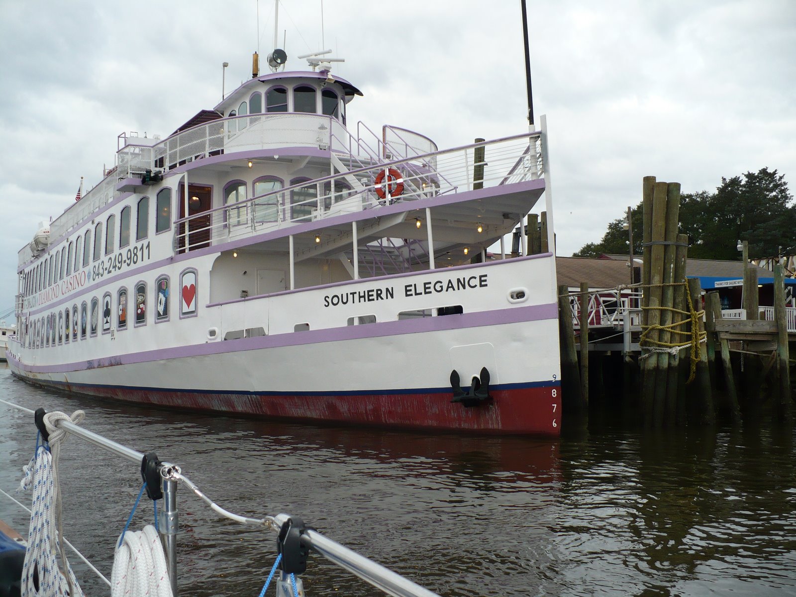
The Good Side of Commercial Traffic

Woody, Don and Nancy are eating fresh shrimp at the R.E. Mayo dock and we are eating tacos. We have too much food aboard to buy any of the local seafood…a lesson we will remember next time through. But, no worries, mates! We’ll have plenty of time to buy and eat inexpensive, fresh shrimp when we return after the Christmas holidays.

We made over 55 miles today starting at 0730 under a sunny sky and light winds. Later in the morning the wind rose to 25-35 knots from the west…on our nose of course as we motored along the Alligator River – Pungo River Canal. By the time we exited the canal, the wind was getting lighter, the sun was still shining brightly and we were in short sleeved shirts in the enclosed cockpit of our boat…altogether a very enjoyable day in phenomenal weather.

Sunrise at Bear Creek Sunset at Bear Creek
After we crawled our way back into the secluded, protected anchorage…thanks to our new Garmin chartplotter…we settled into our routine of sitting for awhile in the cockpit enjoying the scenery and relaxing as the afternoon turns into evening and the sun gets low on the horizon, By sunset, we are down below and planning our next day’s route. Dinner is cooked and eaten by 7:30 PM and we are settled in to bed early most nights. Sarah usually by 9:00 PM and Joe posting our web log and trying to finish up before the evening news. We have satellite radio, CDs, DVDs and television to entertain us. TV reception varies from very good to barely acceptable. Cellular telephone…so far…has been very good with a couple of exceptions. Broadband access is the big surprise. With the exception of last night, we’ve had internet access at every anchorage and marina we’ve stayed at for the past month and a half.

After a pleasant couple of days, it’s starting to get cooler again. Tomorrow is supposed to be fair and mild and it will get cooler toward the end of the week…but then we hope to be at least 200 miles further south, so we’ll see how much warmer weather we can gather to keep ourselves warm. We’re planning on being south of Morehead City, NC tomorrow evening this time. We’re trying to be a bit more aggressive without disrupting the pleasure of this trip since we want to be home for the holidays and not be too rushed either getting to Hilton Head or getting ready for the holidays…no small balancing act, but we're doing our best!